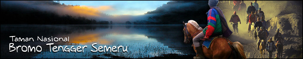
|
I
Inside
Area I
Outside Area I
TN-BTS
(Bromo Tengger Semeru National Park) area is awell known
natural tourism objects and one of tourism destination places. Both
for domestic and foreign tourists.
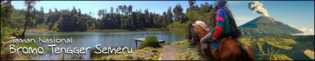
Tourism
objects that exist in TN-BTS area are:
1.
Tengger Cadera.
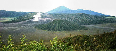
The mayor atractivenees of TN-BTS is its unique and spectacular
natural phenomena and those are easily enjoyed from a relative cloose
positition.
Tengger caldera (crater) in which 5 (five) mounts are located could
be a special interesting thing in the tourism, including its history
of formation.
According to esher (1980 et al) formerly mount Tengger was a very
big /large mountain whit a peak level of 4,00 meters above sea level.
About one milion or one milion and a half years ago have head activities
to from a very large caldera of 8-10 Km mount Tengger activities
does not stop only to that , but its activities is still seen whit
emergence of a new crater at center of the caldera the crater is
higher nad higher until sometime it erupst.
Tengger caldera is very large and well known whit is name laut pasir
Tengger. Because of its unique this caldera was handled by the govermentin
1919 and stated as a natural conservation . however this area apparently
attracted tourist to come. Then the area was changed to be as a
national park (especialy in Cemorolawang part.)
2.
Lava Crater
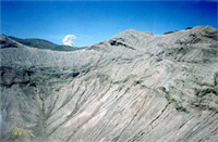
The lava crater is at a sand sea of kutho part, from far looks like
a pile of bricks of ex- palace . the local people cal the well/
crater as Sumer pitu(well seven).
Based on geologikal history, lava craters have com from lava burning
mold of mount Kursi.
This time is lava is vomited from the crater and floods out directly
down to the sna sea because the slope of the sand sea leads to horizontal,
velocity of the mold is slower and slower to 5 meters per hour and
its surface is firstly frozen and solidified while the inside part
ist still mold/ more liquit .
lava flow will stop after the lava matters have undergone all solidification
. next eruptions cause shaking that affec ist weak ceilings fall
and from some wells. There are more than 20 wells and they are scattered
around.
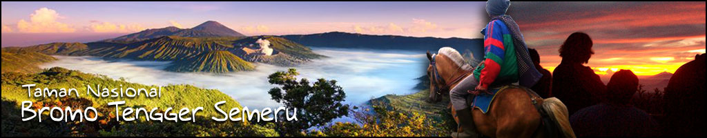
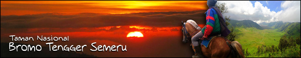
3.
Mount Bromo
Mount Bromo is one of five mounts located within Tengger mountains
on its sand sea.
Atractiveness of this mount is bat to the date it is still active
and easily visited /ascended. This mount bromo tourism objec has
a natural atraction that atrac visitor because of this unique natural
phenomena in from of of a crater on the crater covered by sand sea.
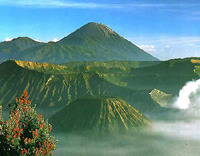
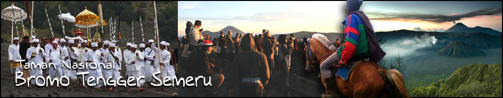
The natural beauty and wondervul valley are vascinating panorama,
plus ist serene atmosphere and peace we well fel while visiting
this area. To get the peak of mount Bromo , we use prepared stairs
/steps of concrete stuff. When we get the peak we will see Brome
a large caving crater whit is smoke out of the bottom . it shows
the vulcano is still active. From the peak we see / enjoy the view
of brome crater whit ist thin cloudy smoke, and the backward side
we can see the beautifullness land countains sand see whit its natural
silhuets that very impresisive.
Its other atracctiveess, is that volcano is a place of afinal ritual
ceremoni (kasada) of Tengger communlty that has is reprensented
by throwing farming product like the fruits and grain onto Moutn
Bromo crater. This ceremony has attrated tourists to see the annual
ceremony.
4.
Mount Widodaren
mount /cave Widodaren is located beside mount . Batok and is tourism
potentials objec whit the special atractivenes . one of the appeal
of this objec is that this location consitutes a sacred tourism
objects thar from a cave and a sarced water resource.
Inside of that cave and asarced water resources.
Inside of that cave there is a somewhat broader place and inside
that place there is abig stone that is used to provide somethings
to be sacrificied and put nadar that also utilized as the place
for meditation especially for comunities of Tengger for praying
to the syangyang widi. Around that cave ,exactly beside there are
believe that eficacy of the water resource that will never dry and
according to comonity of Tengger , it is sacred water from widodaren
(Mendhak Tira) beside, there ist belive that the efficacy of the
water may keeo young and may get the spousefor the umaried person
In order to rach this object has been made a narrou lane whit the
trend nearly forty five degree. So that suggested to tourits for
carefuly walking when passing this lane.
Another atlaractivenes , when we have already reached the cave ,
we wel sea abeautifull view at the bottom. I,e sand seaand the adjancent.
The more beautifull view when we are enjoiying the view at morning
whit the yellow shined sun rise appears at our front.
5.
Mount Penanjakan
Peak of moutn Pananjakan is the highets place if compared whit another
places of mountainous Tengger. For these reason. In this are we
may see the natural beautifulness in the bottom side such as san
sea and mount. Bromo complex Dsk.
That is backgrounded by mount. Semeru whit its thick smoke come
out this peak of Pananjakan may be seen the beautifulnes of sunrise
in the eastward behind the hill we can enjoy the situation mentioned
above whit the peacefull situatiound without the noisiness.
The provided facilitation are shelter, plaza MCK (places for
washing and bath) and cafetaria.
6.
Ranu Pane and Regulo
Ranu pne (1 ha) and Ranu regulo (0.75 ha) are two of four lake availabel
inTN-BTS.
Both lakes the heigt is 2,200 m of sea surface. Both are having
a sufficient beauty view , from this place we can see the very fascinating
view of mount Semeru whit its smoke comes out and enjoying the wonderfullnes
of situations around the lake observing the widl animal in particular
the living of belibis bird and observing the cultur and custom of
the native inhabitanst.
Arount the lake there is a rural residence (pendukuhan) that consituate
last place for TN-BTS tourists in particular for the climber . beside
in this rural residence there aer several little shops offering
the food and beverage and the equipment for the climber .beside
in this rural residence there are in habittants who quiding or carrying
the equipment of the climber until reach to top of mpunt Mahameru
(poter).
Beside the tourist for the purpose of climbing ,Ranu Pane -regulo
usualy utilized by the tourist for campng obseving the field and
activites of open natural tourism. The facilities are provided in
ranu pane rgulo are pndok pendaki , pondok jaga , information center
, pondok peneliti and camping ground.
7.
Ranu Kumbolo
Ranu kumbolo (8ha) is located at the heigt 22,390 m over the sea
surface ,I,e ranu- pane and mount .Semeru historically and geologicaly.
Ranu kumbolo is shaped from masive craters mount . jambangan that
has solidefied so that the filing water otomatically not flows down.
Until today, Ranu kumbolo is the potentials of delighfullly toursm
object. The atractiveneses are that at a yard in wich relatively
higger than the sea surfarce there is a lake whit the clear ,freas
and unpolluted water , so that atracted the tourist to visit this
park. For the climbers Ranu Kumbolo is he stop place to prepare
nex journeianother attractiveness.in the west fringe of lake there
is a monument . it is the legaci of acient, supposed that this monument
is the legaci of majapahit empire. However until today has not earned
the certainty.
In particularn at the watery area of the lake we can see the living
of wild animal,I,e Belibis brid . for the enverimental abservers
Ranu Kumbolo is essentially the natural laboratori for the studiy
and observation of nature that full whit the very rich knowledge.
The facilities are provided in Ranu Kumbolo are pendok pendaki (70m)
and MCK that are utilized by the climbers for taking rest, beside
the availability of a relative evenly for camping ground. Needs
of water may be met whit lake water.
8.
Kalimati
Kalimati is the last camping location before sustain the journey.This
places ususlly used for taking rest , because availabelity of water
source. That is gap about 500 m from kalimati. And both the yard
is relative evenly and also it has been established facility of
pondok pendaki and MCK.
Temperature in kalimati relatively cooler than other places, because
kalimati area is the vallei of any adjacent hills.
9.
Arcopodo
Arcopodo or recopodo is located in the middle between Kalimati and
Mount Semeru. In this places there are twin statue (Arcopodo or
rercopodo ) and some monuments of the died and lots climbers when
climbing the moutn . Semeru in this places utilized for temporarily
resting before sustain the journey to the top of Mahameru.
8.
Mahameru and Kawah Jonggring Saloko
Mahameru is another name of the peak of semeru Montain in java (3,676
m above the sea surface) it has wide kawah called Jonggring Saloko.
Since it is the highes Mountain , from its peak ,we can enjoy wonderful
scenery below it such as
-west side : malang City, north side : Kepolo mountain and Tengger,
south side :shout beach line, east side : Argopura Mountain
Among nature lovers , especialy climber from eatsjava , even some
climber from yokyakarta bandung , semeru mountain is challenging
one and always be place for nice climbing every year.
|