Tourism Destinatons
About Sampang Regency
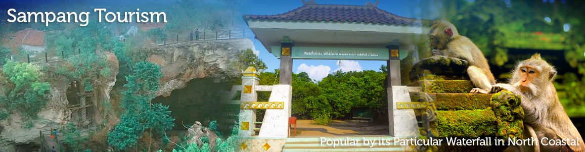
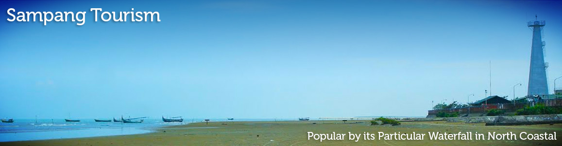
Sampang is one of Madura’s regency that has many kinds tourism object. Sampang is a tropical area, so that it is comfortable for the tourist to enjoy the tourism objects. There are many kinds of tourism objects in Sampang, such as; mandangin island tourism spot, Camplong beach, Madengan tomb, recreation of Klampis reservouir, Toroan waterfall, the ruin Raden Segoro, ruins of Pababaran. Those tourism objects, is become the main icon of Sampang regency.
TERITORIAL PROFILE
GEOGRAPHICALLY
The geographical position of Sampang Regency is between
6° 05' to 7° 13’ South Latitude and 113°
08' to 113° 39' East Longitude with district boundaries
are:
South side: Java Strait
North side: Java Sea
West side: Bangkalan Regency
East side: Pamekasan Regency
Land territory is located along the North and South shore,
comprises of Banyumas, Ketapang, Sokobanah, Camplong,
Sampang, Torjun, and Sreseh districts with the altitude
of 0 up to 50 M above sea level. Based upon the spreading
of sort of soil and geology of soil in Sampang Regency,
it can be used to divide the district based on soil fertilization,
they are:
1. The South part of Sampang is relatively fertile starting
from Sampang, Camplong, Torjun, Jrengik and Sreseh Sub
districts.
2. The North part of Sampang is a less fertile district
starting from Sokobanah, Ketapang and Banyumas Sub districts.
3. The East part and west part of Central Sampang is relatively
barren compared to south and north Sampang that consists
of Kedungdung, Tamelangan, Robatal and Omben districts.
CLIMATOLOGY
Sampang is situated in a tropical climate. It having dry
and wet period with a rain fall around 1,800 mm to 2,000
mm. The average rainy day is 75 days per year. Temperature
moves from 29° C to 30° C. Every year, there are
7 wet months and 5 dry ones, so these conditions influence
farming.
THE USAGE OF LAND
In general the usage of land in Sampang Second level Regency
is rural characteristic, except in the capital city of
Sampang regency. The agriculture area especially like
rice cultivation, is found on a relatively flat area.
The other agriculture harvest is found on in a higher
area. While the use of land are:
- Technical Rice Field: 3,615 Ha (2.93%)
- Semi Technical Rice Field: 998 Ha (0.81%)
- Simplistic Rice Field: 194 Ha (0.16%)
- Rain Irrigated Rice Field: 15,862 Ha (12.86%)
- Dry (non irrigated) Field: 68,024 Ha (55.17%)
- Plantation: 15,399 Ha (12.17%)
- Forest: 617 Ha (0.51%)
- Embankment: 5,675 Ha (4.60%)
- Others: 12,918 Ha (10.48%)
TOPOGRAPHICALLY
The topography of Sampang Regency consists of:
a. Hilly area with a land slope aroud 25% to 40% is located
in the middle part of Sampang. It is a barren and dry
area that sompress Jrengik, Tambelangan, Kedungdung, Robatal
and Omben districts. The width of this region is about
60% from the whole area with an elevation of 50 up to
118 M above sea level.
ADMINISTRATIVE AREA
Sampang Regency is located in a political regency administered
by Governor Assistant in Pamekasan, consisting of 4 political
districts administered by Regent Assistant, 12 districts,
8 Regions of Sub district Representation, 180 Villages
and 6 political districts administered by Lurah (Village
Chief) with details are:
-
Sampang political district administered
by Regent Assistant comprises:
- Sampang district consisting of 12 Villages and 6 political sub districts administered by Lurah (Village Chief).
- Camplong district consist of 14 Villages
- Omben district consist of 20 Villages -
Torjun political district administered
by Regent Assistant comprises:
- Torjun district consisting of 18 Villages
- Jrengik district consisting of 14 Villages
- Sreseh district consisting of 12 Villages -
Kedungdung political district administered
by Regent Assistant comprises:
- Kedungdung Subdistrict consisting of 18 Villages
- Tambelangan Subdistrict consisting of 10 Villages
- Robatal Subdistrict consisting of 12 Villages -
Ketapang political district administered
by Regent Assistant comprises:
- Ketapang Subdistrict consisting of 14 Villages
- Banyumas Subdistrict consisting of 20 Villages
- Sukobanah Subdistrict consisting of 12 Villages
The population of Sampang Regency based on 1990 census, is 704,445 with 337,541 males and 365,594 females.
While in 1980 census result the population is about 604,632. This means that during the period of 1980 to 1990 the rate of population growth reached 1.55% per year. The population density of Sampang Regency by the end of1991 reached 570 people/km2.ADMINISTRATION
The regency of Sampang is divided into 4 districts,.........with 12-sub district, 180 villages and 6-sub district.
The geographical division of the...District and.... Sub district can be outlined of:
Sampang district
Torjun district
Kedungdung district
Ketapang district
And the sub district
sub district Sreseh 12 village
sub district Torjun 18 village
sub district Sampang 12 village and 6 kelurahan
sub district Camplong 14 village
sub district Omben 20 village
sub district Kedungdung 19 village
sub district Jrengik 14 village
sub district Tambelangan 10 village
sub district Banyuates 20 village
sub district Robatal 16 village
sub district Ketapang 14 village
sub district Sokobanah 12 village

Madura Annual Bull Race
Karapan Sapi Karapan Sapi, is Madura annual traditional event, it is such a bull racing tournament. It usually being held at week end within August to September, or ideally before or after the fasting month. Date back to the early begin, Karapan Sapi was exist before 15 Century. The championship is starting from the district level to the regency level and forwarded to the level Residence. Last, the final will be held on September or October in the city of Pamekasan to compete for President Cup. Karapan Sapi is such…
A Day In Toroan Waterfall
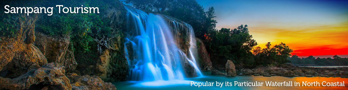
Toroan Waterfall Toroan waterfall, is another small hidden paradise that lies in Ketapangdaya Village, Madura island. Toroan waterfall is the only waterfall in Madura, and it become a particular. The particular is coming from the way of the waterfall flows directly to the ocean, precisely, Java Ocean. It has only 10 Meters high and the fall is quite high that make such a lagoon within the rocks. During the high tides, the entire area is covered by sea water and that makes the waterfall is pouring down into the ocean.…
Here The Gorgeous Winner
Karapan Sapi Karapan Sapi, is Madura annual traditional event, it is such a bull racing tournament. It usually being held at week end within August to September, or ideally before or after the fasting month. Date back to the early begin, Karapan Sapi was exist before 15 Century. The championship is starting from the district level to the regency level and forwarded to the level Residence. Last, the final will be held on September or October in the city of Pamekasan to compete for President Cup. Karapan Sapi is such…
Happy Day On Toroan Waterfall
Toroan Waterfall Toroan waterfall, is another small hidden paradise that lies in Ketapangdaya Village, Madura island. Toroan waterfall is the only waterfall in Madura, and it become a particular. The particular is coming from the way of the waterfall flows directly to the ocean, precisely, Java Ocean. It has only 10 Meters high and the fall is quite high that make such a lagoon within the rocks. During the high tides, the entire area is covered by sea water and that makes the waterfall is pouring down into the ocean.…